Normandy
THE SCENERY & ROMANCE OF ITS ANCIENT TOWNS
DEPICTED BY
GORDON HOME
PREFACE
This book is not a guide. It is an attempt to convey by pictures and description a clear impression of the Normandy which awaits the visitor.
The route described could, however, be followed without covering the same ground for more than five or six miles, and anyone choosing to do this would find in his path some of the richest architecture and scenery that the province possesses.
As a means of reviving memories of past visits to Normandy, I may perhaps venture to hope that the illustrations of this book—as far as the reproductions are successful—may not be ineffectual.
GORDON HOME
EPSOM, October 1905
CONTENTS
LIST OF COLOURED ILLUSTRATIONS
CHAPTER I Some Features of Normandy
CHAPTER II By the Banks of the Seine
CHAPTER III Concerning Rouen, the Ancient Capital of Normandy
CHAPTER IV Concerning the Cathedral City of Evreux and the Road to Bernay
CHAPTER V Concerning Lisieux and the Romantic Town of Falaise
CHAPTER VI From Argentan to Avranches
CHAPTER VII Concerning Mont St Michel
CHAPTER VIII Concerning Coutances and Some Parts of the Côtentin
CHAPTER IX Concerning St Lô and Bayeux
CHAPTER X Concerning Caen and the Coast Towards Trouville
CHAPTER XI Some Notes on the History of Normandy
LIST OF COLOURED ILLUSTRATIONS
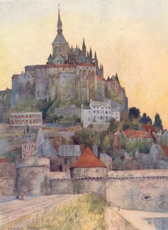
MONT ST MICHEL FROM THE CAUSEWAY
ON THE ROAD BETWEEN CONCHES AND BEAUMONT-LE-ROGER This is typical of the poplar-bordered roads of Normandy.
THE CHÂTEAU GAILLARD FROM THE ROAD BY THE SEINE The village of Le Petit Andely appears below the castle rock, and is partly hidden by the island. The chalk cliffs on the left often look like ruined walls.
A TYPICAL REACH OF THE SEINE BETWEEN ROUEN AND LE PETIT ANDELY On one side great chalk cliffs rise precipitously, and on the other are broad flat pastures.
THE CHURCH A BU KİTABI OKUMAK İÇİN ÜYE OLUN VEYA GİRİŞ YAPIN!
Sitemize Üyelik ÜCRETSİZDİR!
